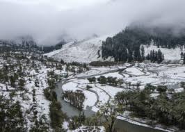
Jammu, Jan 22: A strong Western Disturbance is expected to affect Jammu and Kashmir from Wednesday afternoon, bringing widespread snowfall to the Kashmir Valley and hilly districts, along with heavy rain in the plains.
The system will initially impact higher reaches of North Kashmir and by night, most parts of the Union Territory will come under its influence. Snowfall is likely in Kashmir plains, as well as in Poonch, Doda, Kishtwar, Ramban, and Kathua districts.
Though the disturbance is expected to weaken within 24 hours, intense snowfall rates are likely due to high moisture availability. The peak period is forecast from Wednesday night through Thursday late afternoon, with precipitation possibly lingering in some areas until the morning of January 24.
Snow accumulation in the plains will depend on density: dry snow could result in 4 inches to 2 feet, with higher amounts near the Pir Panjal belt, especially Shopian. Wet snow may leave 3 inches to 1.5 feet, while higher elevations could receive 2 to 4 feet of fresh snowfall.
Moderate to heavy rainfall is expected in Jammu plains, and strong wind gusts may accompany the system. Travel disruptions are likely on January 23, potentially affecting flights, trains, and road connectivity.
The disturbance will also usher in a cold wave, bringing prolonged winter conditions across J&K through the remainder of the month.


